Wildfire
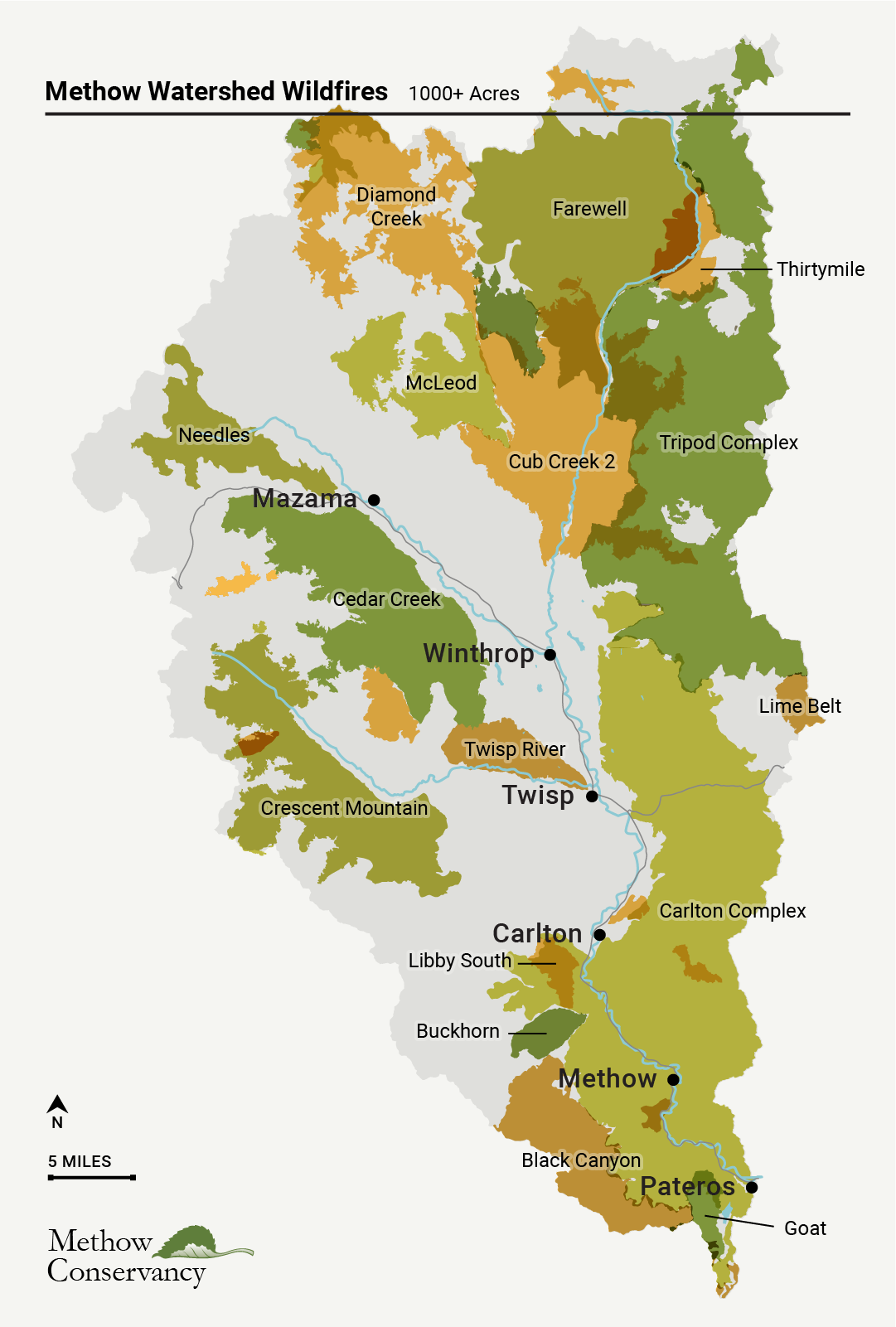
From 2000 to 2025, wildfires greater than 1,000 acres in size burned an average of 28,742 acres per year, and in total burned 59 percent of the Methow Watershed. In comparison, from 1970 to 1999, wildfires greater than 1,000 acres in size burned an average of only 5,392 acres per year, and in total burned 3.7 percent of the Methow Watershed.
Burn severity data indicate that about 29 percent of the total fire acres during the 2000 to 2025 time period burned at high severity, about 26 percent at moderate severity, about 30 percent at low severity, and about 14 percent unburned or underburned, with about 1 percent of the fire acres having no fire severity level indicated.
Acres Burned and Fire Severity, 1000+ Acres, 2000-2025
Methow Watershed Wildfires, 1000+ Acres, 2000-2025
Data compilation and analysis by Julie Grialou. Graphics and photography by Benjamin Drummond.
Last updated April 2026.