First Tuesday: Beauty and the Beast - Lidar Imagery and Debris Flows
When: Tuesday, November 3, at 7pm.
Where: TBD
Join the Methow Conservancy, the Methow Watershed Council, and the Washington Geological Survey for a First Tuesday talk all about flooding, debris flows, and the stunning lidar imagery that can help us understand these phenomena on our home landscape.
Beauty and the Beast: How lidar reveals stunning landforms and geologic hazards
with Daniel Coe and Emilie Richard, Washington Geological Survey
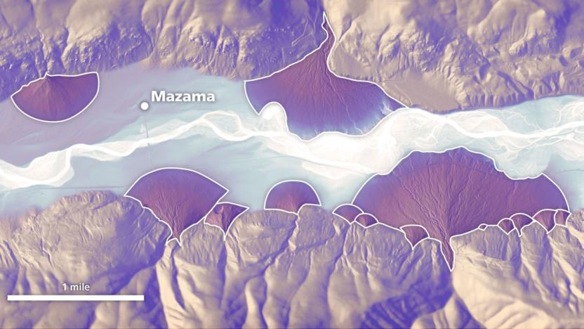
In the past few decades, the increasing prevalence of lidar (laser-derived terrain data) has allowed geoscientists to "see through the trees" and accurately map landslides, faults, glaciers, and other geologic features with much greater detail and accuracy than with previous technologies.
This talk will share examples of lidar-based landform images from across the region and highlight the usefulness of lidar-based alluvial fan mapping in the Methow Valley. Daniel and Emilie will explain how flooding and debris flows form alluvial fans and how wildfire increases these hazards, drawing on recent mapping and ongoing research, including some research from right here in the Methow Valley.
-----------------
This presentation is free and open to the public. Contact Bridger with any questions.
We encourage attendees to carpool to our events if possible. Call your neighbors, fill your car, reduce your emissions, and enjoy the company!
Banner Photo Courtesy Washington Geological Survey (Washington State DNR)
About Emilie
Emilie is a landslide geologist with Washington Geological Survey's Post-Wildfire Debris Flow Program, specializing in mapping alluvial fans and assessing debris flow hazards after wildfires. Using lidar and GIS, she identifies high-risk areas and supports rapid hazard evaluations for communities impacted by fire. As part of the Wildfire Associated Landslide Emergency Response Team (WALERT), she also collects field data and monitors post-fire conditions to better understand and communicate debris flow risks. When she is not studying debris flows, Emilie enjoys felting, river rafting, and raising chickens in her backyard.
About Daniel
Daniel has been making maps in the Pacific Northwest for the past two decades. He is the graphics editor for the Washington Geological Survey in Olympia, Washington, where his work explores natural hazards and landforms in Washington state. Daniel’s cartographic designs have been featured in National Geographic, High Country News, and the Atlas of Design, among others. When not making maps, he is usually out exploring the forests and waters of Washington. dancoecarto.com
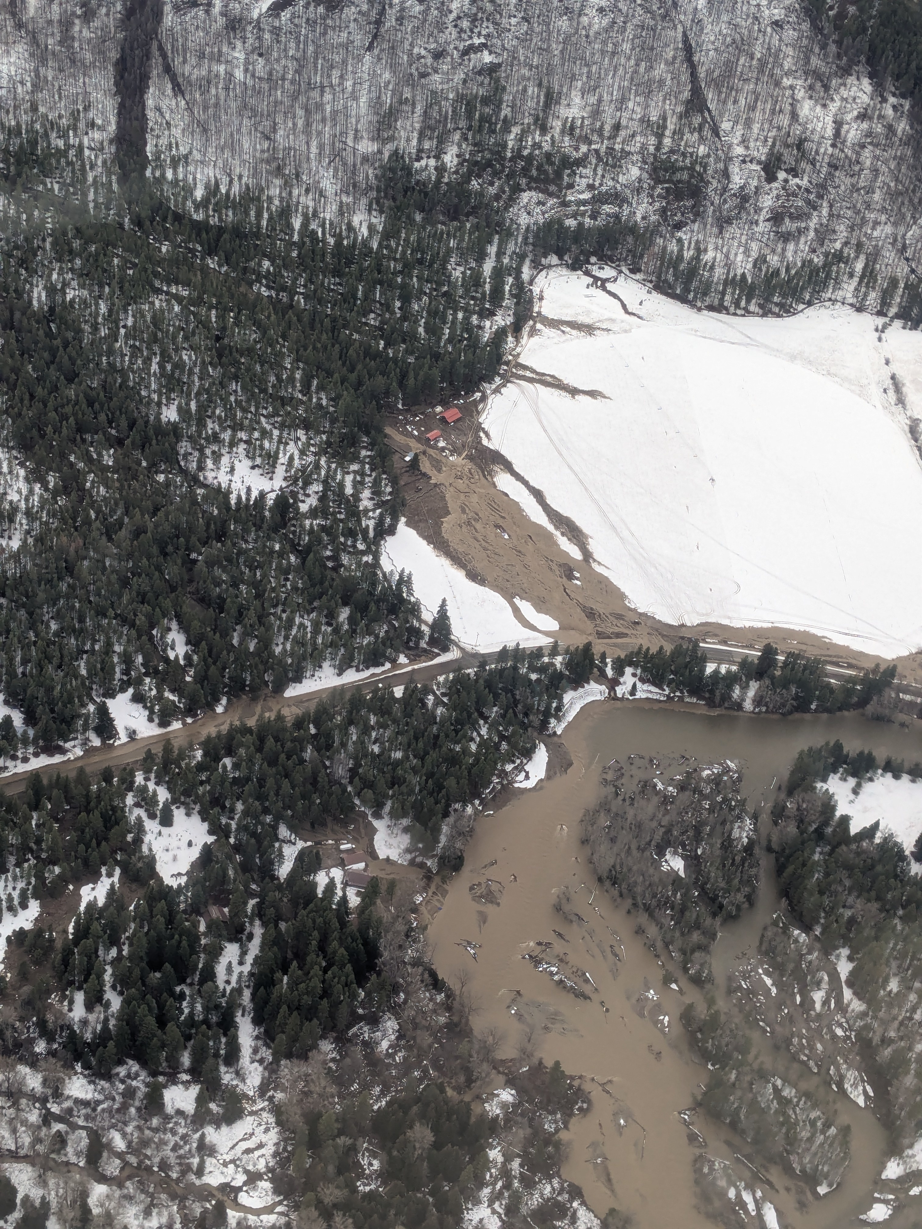
Photo by Lowell Neal